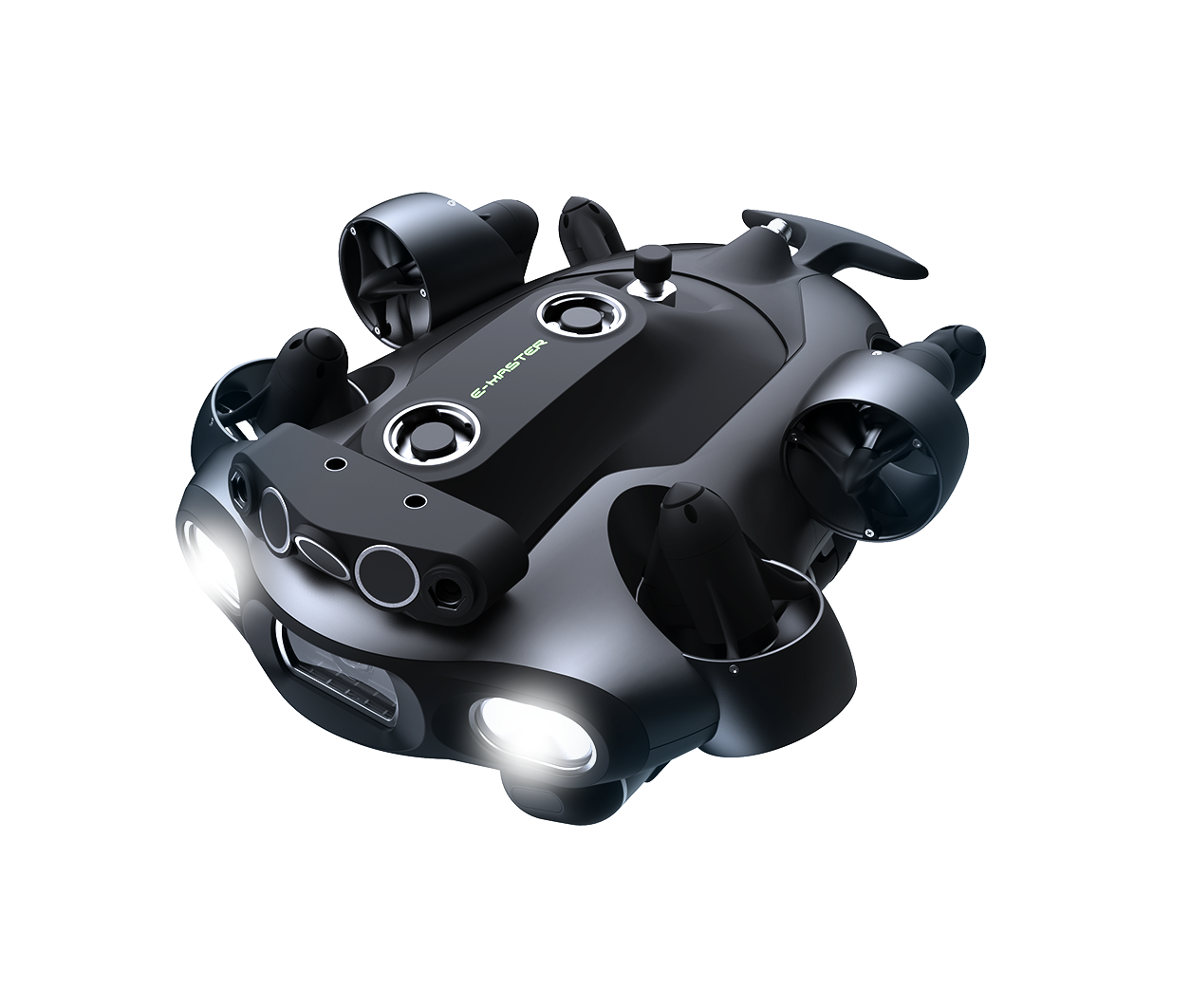


Meet FIFISH E-MASTER: Redefining Advanced Underwater Inspections, Measurements, and Surveys
2024-09-28
Share:


Meet FIFISH E-MASTER: Redefining Advanced Underwater Inspections, Measurements, and Surveys

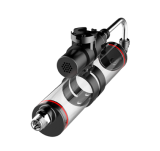
QYSEA Technology announces the launch of its next-generation compact ROV, the FIFISH E-MASTER, tailored for marine professionals. Equipped with advanced sensors and sonar systems, the E-MASTER enhances operational efficiency and reliability for marine professionals in key industries including civil infrastructure, maritime shipping, offshore energy, underwater surveillance, and subsea explorations.

Real-time & Offline Smart Measurements: Evaluate with Enhanced Accuracy and Ease
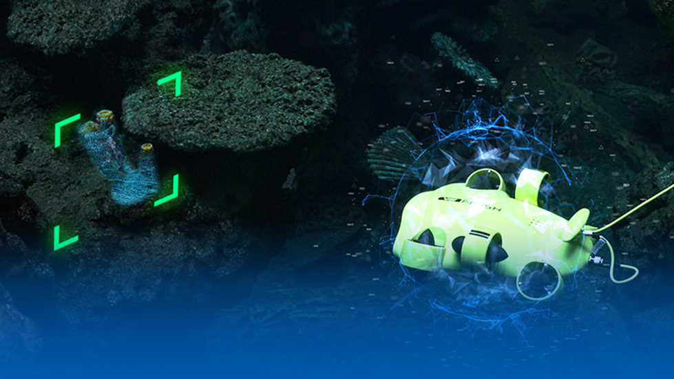
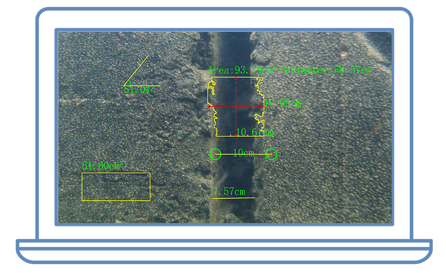
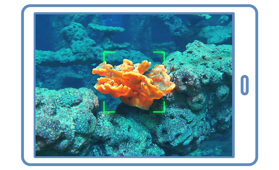
QY-MT is QYSEA's AI-powered underwater measurement system, enabling real-time analysis of underwater objects, fractures, and damage with high accuracy and multiple measurement methods. Offering real-time data visualization, QY-MT delivers a non-destructive approach to underwater measurements. Users can leverage the post-processing system for enhanced multi-measurement accuracy or utilize FIFISH APP to measure objects efficiently in real-time using a virtual AR ruler.

2D & 3D Seafloor Mapping: Generate Detailed Seafloor Visualization & Insights
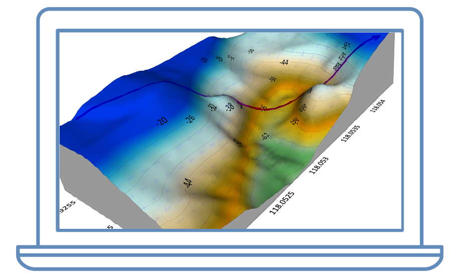
FIFISH E-MASTER facilitates dynamic bathymetric surveying, enabling users to map seabeds, riverbeds, and reservoirs while creating customizable 2D and 3D topographic maps. This system allows for automatic depth data collection, estimation of reservoir capacities, and the generation of data reports with a single click. Experience a comprehensive solution for detailed seafloor visualization and insights, allowing for accurate monitoring of changes in target areas over time.

Subsea Automatic Navigation: Explore and Survey with Intelligence
FIFISH E-MASTER’s Underwater Inertial Navigation System (U-INS) provides advanced autonomous navigation, combining deep learning with sensor data for precise positioning, velocity, heading, and attitude. It enables automated mission planning, one-click return-to-home, and real-time motion tracking with visual overlays of historical paths. Operators can benefit from efficient, self-guided movement, custom maps, and point-of-interest recording, enhancing subsea mission efficiency.

Dynamic & Steady Hovering: Achieve Precise Control in Challenging Waters
FIFISH E-MASTER delivers cutting-edge stability and safety features, including its built-in forward and downward Q-DVLs (Doppler Velocity Logs) for stable hovering and resistance to water flows above 3 knots. It ensures reliable operation in turbulent conditions with smart collision avoidance, enhancing mission safety and inspection efficiency by automatically preventing collisions and maintaining a consistent position.

Enhanced Performance, Trusted Features
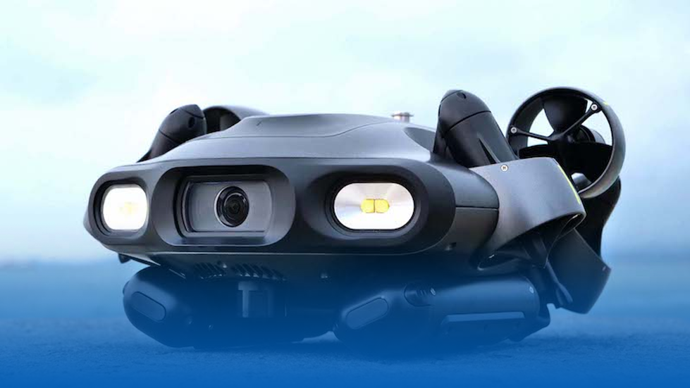
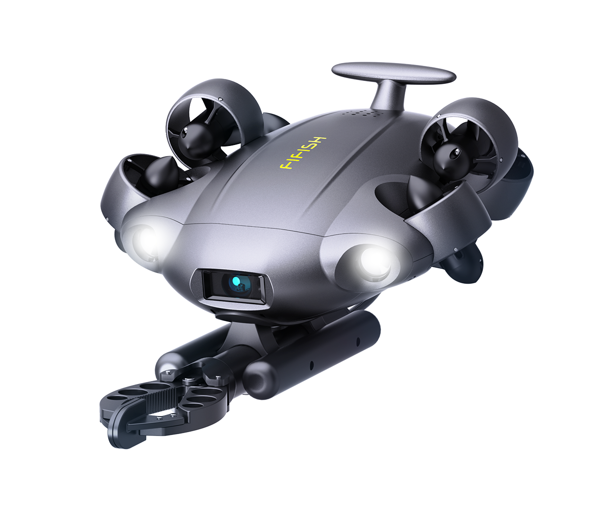
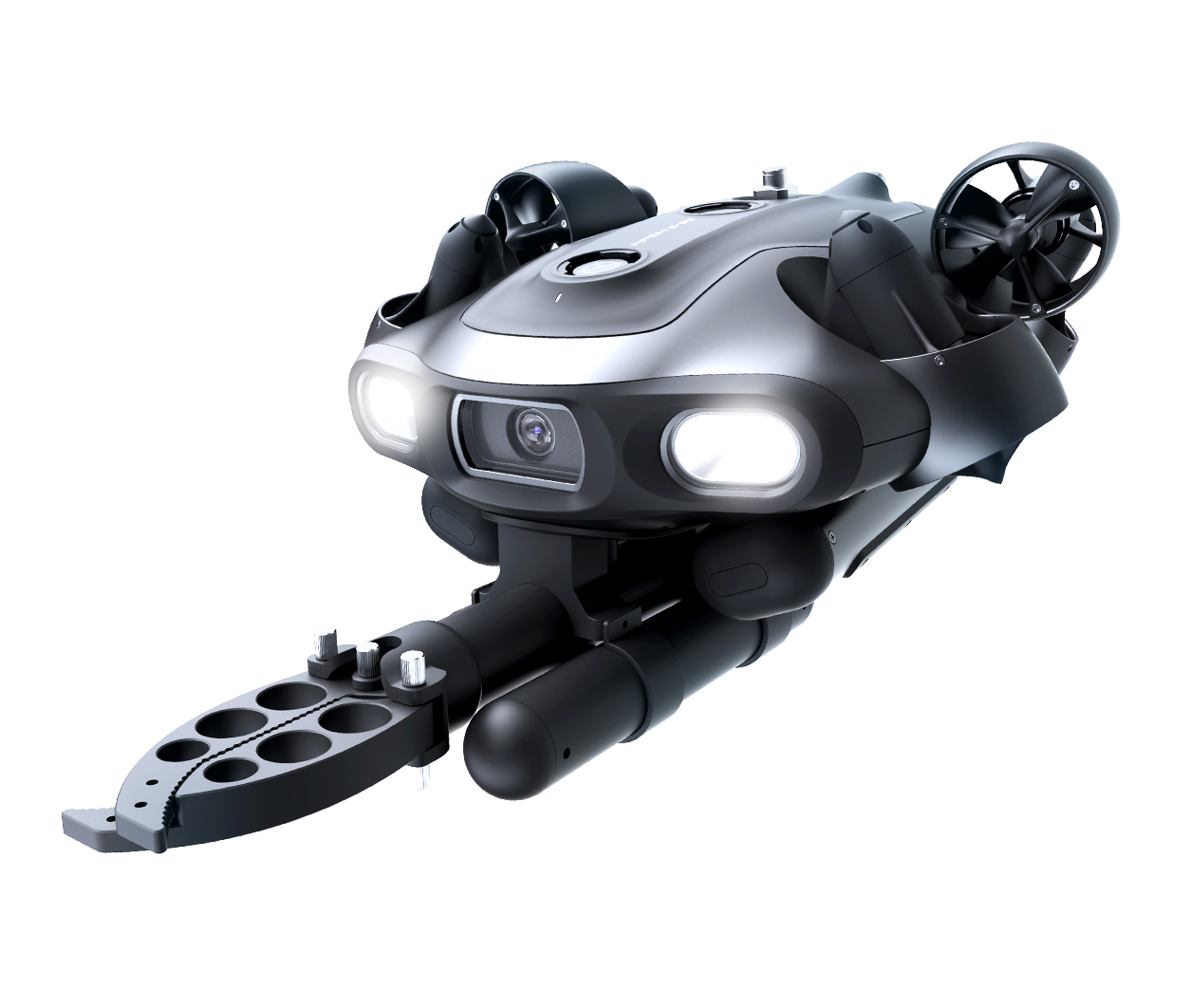
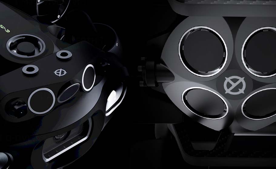
As part of QYSEA's award-winning E Series of ROVs, the FIFISH E-MASTER builds on the series' foundational features to deliver enhanced performance. It offers a 200m dive depth, a modular system design for easy maintenance, and hot-swappable power for continuous operation. With a robust multi-tool payload enabling simultaneous integrations, the E-MASTER also provides a 146° ultra-wide field of view for a distortion-free underwater panoramic view. Powered by its Ring-wing Motor with a 30% power boost, E-MASTER achieves over 3 knots of propulsion, ensuring efficiency and stability in demanding environments.
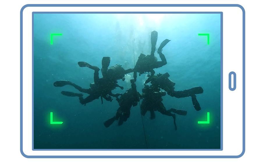
FIFISH E-MASTER also leverages QYSEA’s AI smart vision functions that enable diver tracking for operational safety and real-time adaptive visual enhancements for crystal-clear imaging.
Transforming Marine Industries
FIFISH E-MASTER is a compact yet powerful industrial ROV built to tackle the most demanding underwater tasks across offshore energy, subsea infrastructure, subsea security, search and rescue, and more. The E-MASTER represents a significant leap forward in ROV technology, offering professionals an all-in-one solution for precise inspections, measurements, and surveys in challenging and unpredictable marine environments.
Share:
Last News